Author:
Monojit Saha
Published on
November 27, 2025
Categories:
Dummy category | Second category
As the world faces the increasingly dire consequences of climate change, the need for innovative solutions has never been greater. From rising sea levels to more frequent and severe natural disasters, the effects of our changing climate are felt globally. Yet, amid this crisis, there is hope. Hope driven by the cutting-edge tools of science and technology, particularly geospatial technologies, which are helping us better understand and address these pressing issues.
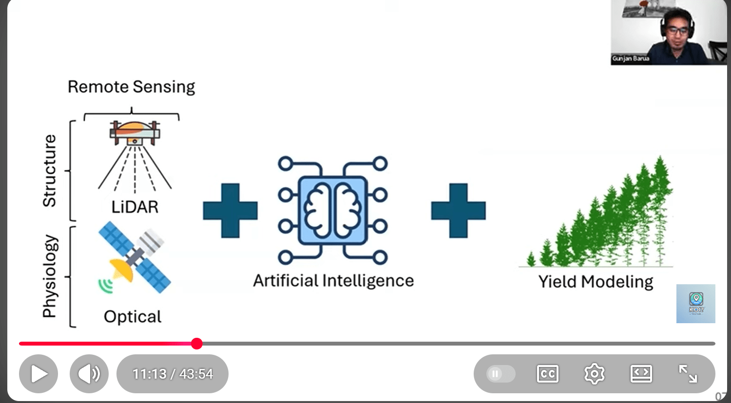
The potential for remote sensing, satellite imagery, and Geographic Information Systems (GIS) to transform our approach to climate change is immense. These technologies are providing real-time insights into the environment, enabling us to monitor ecosystems, predict natural disasters, and design more sustainable solutions for communities at risk. They allow us to view our planet from a new perspective, one that can inform smarter, more informed decisions about how we interact with our environment.
I’ve had the privilege of exploring these exciting innovations through my YouTube channel, Koi?, where I dive into the latest research on climate change, environmental science, and the intersection of these fields with geospatial technology. As a PhD student at the University of Maryland, my research focuses on sea ice and its role in regulating global climate systems. Through the use of satellite data like ICESat-2 and GEDI, I investigate the impacts of changing sea ice dynamics and how they affect ecosystems and human communities, particularly Indigenous groups who depend on Arctic ice for their way of life. But it’s not just about understanding these changes, it’s about finding ways to use this data to inform climate resilience and mitigation strategies.
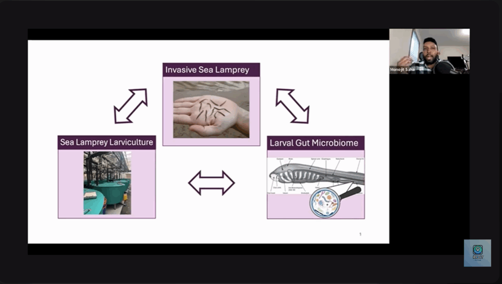
Koi? is a platform where I showcase the pioneering work of scientists from around the world who are using geospatial tools to tackle a range of climate challenges. One such example is the research of Samrin Sumaiya Sauda, a PhD student at Penn State University, whose work on compound flooding, a growing climate threat caused by the combination of heavy rainfall, storm surges, and rising sea levels, is crucial for flood management and climate resilience. By using advanced models and data, Samrin is helping predict when and where these floods will occur, giving vulnerable communities the chance to prepare and adapt.
In another episode, I spoke with Obaidur Rahman, a Master’s student at the University of Utah, whose research focuses on improving wildfire evacuation strategies through the use of geospatial technologies. Wildfires are a growing concern as climate change increases the frequency and severity of these events. Obaidur’s work uses innovative mapping tools to model evacuation routes and response times, helping first responders make better decisions in real-time to protect lives and property. This is the kind of research that has the potential to save countless lives during natural disasters, and it’s a perfect example of how geospatial technology can be used to address climate impacts.
But Koi? isn’t just about showcasing high-level scientific research, it’s about making these conversations accessible and engaging to a broader audience. Early-career scientists like Samrin and Obaidur are often the ones pushing the boundaries of what we know about the environment, yet they rarely get the attention they deserve. By highlighting their work, Koi? is helping foster a global community of researchers, students, and enthusiasts who are passionate about climate science and eager to make a difference.
The beauty of platforms like YouTube is their ability to bridge the gap between scientists and the public. By creating an interactive space for discussions, we can engage viewers from all walks of life in meaningful conversations about climate change. This inclusivity is crucial because the solutions to these challenges require the involvement of everyone, not just the scientific community. We all have a role to play in shaping a more sustainable future.
As we continue to witness the effects of climate change intensify, we must remember that these geospatial technologies are not just tools for understanding the problem, but they are key to solving it. From remote sensing to GIS, these innovations are empowering us to make more informed decisions about everything from conservation to disaster response. By leveraging these technologies, we can create smarter, more sustainable solutions for the challenges ahead.
In the end, the work being done by researchers like Samrin, Obaidur, and many others shows us that there is hope. The future of climate change solutions is bright but it will require all of us to stay informed, engaged, and ready to act. At Koi?, I am proud to play a small part in sparking those crucial conversations, and I invite you to join me on this journey to explore how science and technology can help us build a more resilient, sustainable planet for future generations.
Monojit Saha is a PhD student at the University of Maryland, where they study sea ice and its role in climate change using advanced satellite technologies. He is the host of Koi?, a YouTube channel dedicated to exploring the intersection of geospatial technologies and climate science.